Tropical Storm "Fernand" Forms in the Atlantic Ocean and Moves Away from Land
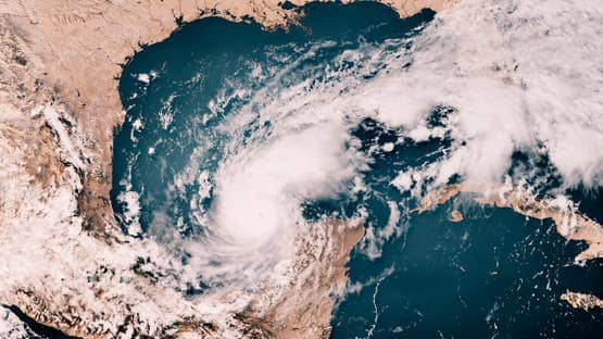
Tropical Storm "Fernand" formed in the Atlantic Ocean on Saturday, becoming the sixth storm of the season. It is expected to remain over open water away from land.
According to the warning issued by the National Hurricane Center at 5 PM (2100 GMT), Fernand was located about 655 kilometers southeast of Bermuda. The storm recorded maximum sustained winds of 65 kilometers per hour and was moving north at 24 kilometers per hour. The winds reaching tropical storm strength extend outward up to 167 kilometers from the center.
Weather models predict that the storm will experience some strengthening over the next 48 hours, with Fernand potentially nearing hurricane strength by Monday, followed by weakening on Tuesday.
Commenting on the storm's path, meteorologists said: "A north and northeast movement is expected to gradually increase in speed over the next couple of days, followed by a turn toward the northeast. According to the projected path, Fernand should move east of Bermuda and across the open waters of the North Subtropical Atlantic."
At the same time, the National Hurricane Center is monitoring another weather development, tracking a tropical wave accompanied by disorganized showers and thunderstorms, located about 1046 kilometers east of the Windward Islands in the Caribbean Sea, according to the warning issued at 2 PM.
Regarding the development of this wave, experts predicted: "Some development of this wave may occur over the next few days as it moves westward at speeds between 32 and 40 kilometers per hour."
They also warned that "heavy rains and storm winds are likely in parts of the Windward Islands as the wave passes on Sunday and Monday," noting that "by Tuesday, conditions over the central Caribbean Sea are expected to be unfavorable for further development."