Satellite Company Enters the "War Zone" in the Middle East in Its Own Way
In an unprecedented move, Planet Labs, a company specializing in Earth imaging via satellites, announced an expansion of its restrictions on access to its images in the Middle East, aimed at preventing exploitation by any hostile parties that may threaten the United States and its allies.
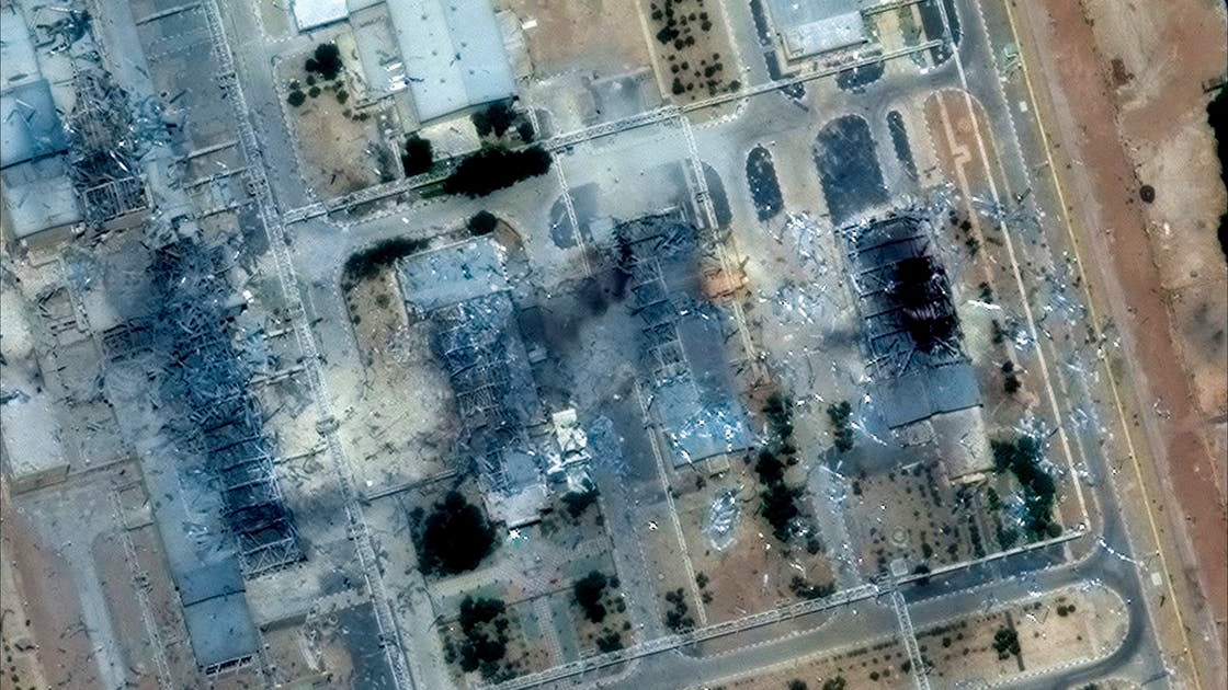
This step comes amid the rising role of space in modern conflicts, where satellite images have become a crucial element in warfare operations, from tracking missiles, securing communications, to accurately identifying military targets.
The company is headquartered in California and operates a large fleet of Earth imaging satellites, continuously selling its updated images to governments, companies, and media worldwide.
Recently, the company informed its clients that it would extend the temporary restrictions period to 14 days, after previously imposing a delay of only four days.
A spokesperson for Planet Labs told Reuters:
"The step is temporary and aims to limit any uncontrolled distribution of images, which could inadvertently reach hostile parties that might use them as a tactical leverage."
He added:
"The current conflict is dynamic and unique, which is why the company is taking strict measures to ensure that our images do not contribute in any way to attacks on allied personnel or civilians."
Space experts indicate that Iran may attempt to access commercial images through intermediaries or third parties, highlighting the importance of regulating access to satellite images in conflict areas.
* The Pivotal Role of Space in Modern Warfare
Today, armed forces rely on space for almost everything:
From target identification, weapon guidance, missile tracking, to securing communications.
U.S. officials confirmed that their space forces were among the "leading entities" in military operations against Iran, without disclosing details of the capabilities used.
High-resolution satellite images, once exclusive to advanced powers, are now commercially available, leveling the playing field among conflicting parties, as seen in the war in Ukraine against Russia.
Experts note that the use of artificial intelligence in image analysis makes identifying vital locations faster and more accurate, making it more difficult to conceal military forces and conduct deception operations.
Chris Moore, a defense industry consultant and retired British Army marshal, stated:
"Specialized image analysis was once reserved for high-level military analysts, but it is now more widely available. In the end, there will be a 'eye that sees everything from space'.