Severe Thunderstorm Watch Hits Northeast United States
Coverage of Severe Thunderstorm Warnings
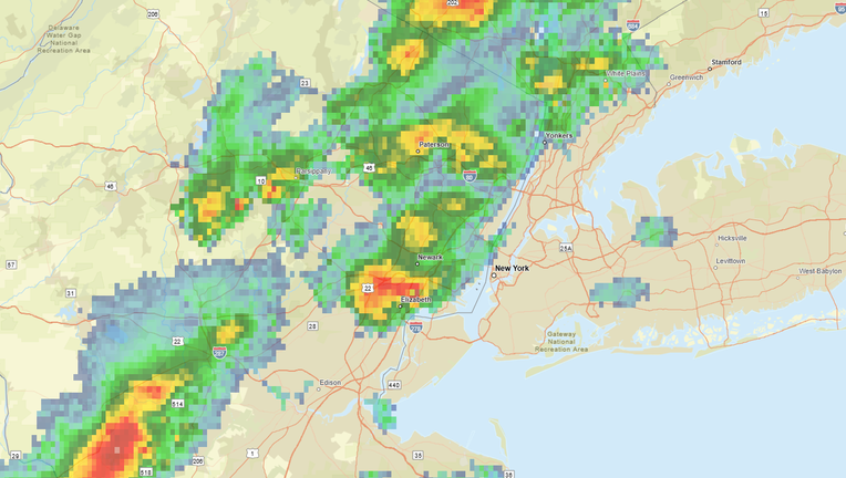
The National Weather Service (NWS) has issued a warning under the name Severe Thunderstorm Watch affecting more than 43 million people. This warning covers major states such as New York, Pennsylvania, New Jersey, and Connecticut, where heavy rainfall and strong winds are expected, potentially causing property damage and power outages.
Weather Forecast for Thunderstorms Today
The forecasts indicate the possibility of:
Heavy rainfall causing flash floods in low-lying and urban areas.
Storm winds reaching speeds of over 60 mph, capable of downing trees and power lines.
Medium-sized hail that may damage vehicles and roofs.
Intense thunderstorm activity with the potential for localized small tornadoes.
Impact of Severe Thunderstorm Watch on Major Cities
New York: Concerns about flash floods in tunnels and low-lying areas.
Philadelphia and New Jersey: Strong winds may disrupt air travel and affect highways.
Boston and New England: Possible thunderstorms in the evening hours with heavy lightning.
Safety Tips During Severe Thunderstorm Watch
Follow official weather alerts via television and apps.
Avoid driving on flooded roads.
Stay away from windows and glass doors during the storm.
Unplug electronic devices to avoid damage from lightning.
Prepare an emergency kit containing a flashlight, batteries, water, and medications.
Conclusion: The Importance of Heeding Weather Warnings
These warnings confirm that the Severe Thunderstorm Watch is not just a routine alert, but an indication of imminent danger that may include floods and localized tornadoes. Adhering to safety instructions and staying in safe places is a crucial step to protect lives and property.