Weather forecast in Syria: Heatwave followed by a cold air mass and thunderstorms.
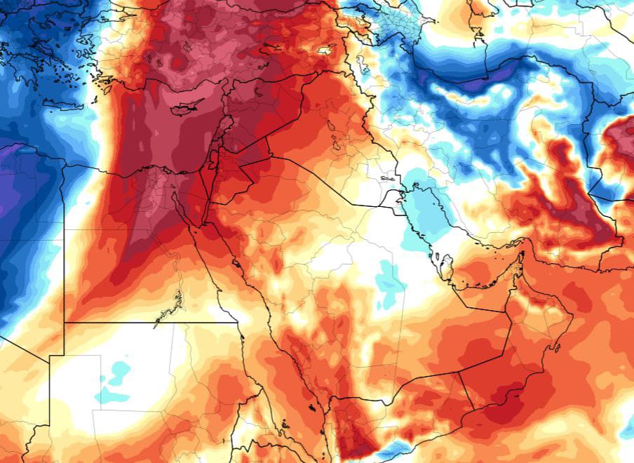
Today, Monday, May 26, Syria is witnessing the peak of a heatwave, with temperatures exceeding the late thirties in some inland areas, including the capital Damascus, according to "Hawar al-Sham."
A noticeable weather change is expected across the country starting from Tuesday, as a "mild temperature" air mass moves in, considered relatively cool for this time of year.
A slight decrease in temperatures will begin on Tuesday and Wednesday, deepening further from Thursday onwards, with more pronounced effects. The country will also experience active wind gusts starting Tuesday, gradually increasing in strength towards the end of the week.
Coastal areas are expected to see heavy rain showers accompanied by thunderstorms starting from Wednesday, with the possibility of a "marine tornado" or locally known as "sea dragon" forming.
Rain, which may be heavy at times, will continue from Thursday until at least Saturday morning. Random rain showers may also reach some parts of the northern and central regions, western and northern rural Damascus on Wednesday night and beyond.
As for the weather on Eid al-Fitr, current weather models indicate stable conditions with temperatures within normal ranges. More detailed weather forecasts for Eid will be published soon.